Social Media Picasa Youtube

Idaho Fire Incident Map

Showing posts with label BLM. Show all posts

Tuesday, June 1, 2021


Taber Fire

For Immediate Release: June 1, 2021 5:00p.m.

Contact: Sarah Wheeler, sarah.wheeler2@usda.gov, 208-497-8553


 Abandoned Campfire Results in 300-acre Fire

Make sure your campfire is out before leaving your campsite - Don’t let your summer go up in smoke

Twitter: @Caribou_Targhee, @BLMIdahoFire | Facebook: @USFSCaribou-Targhee @BLMIdahoFireIdaho


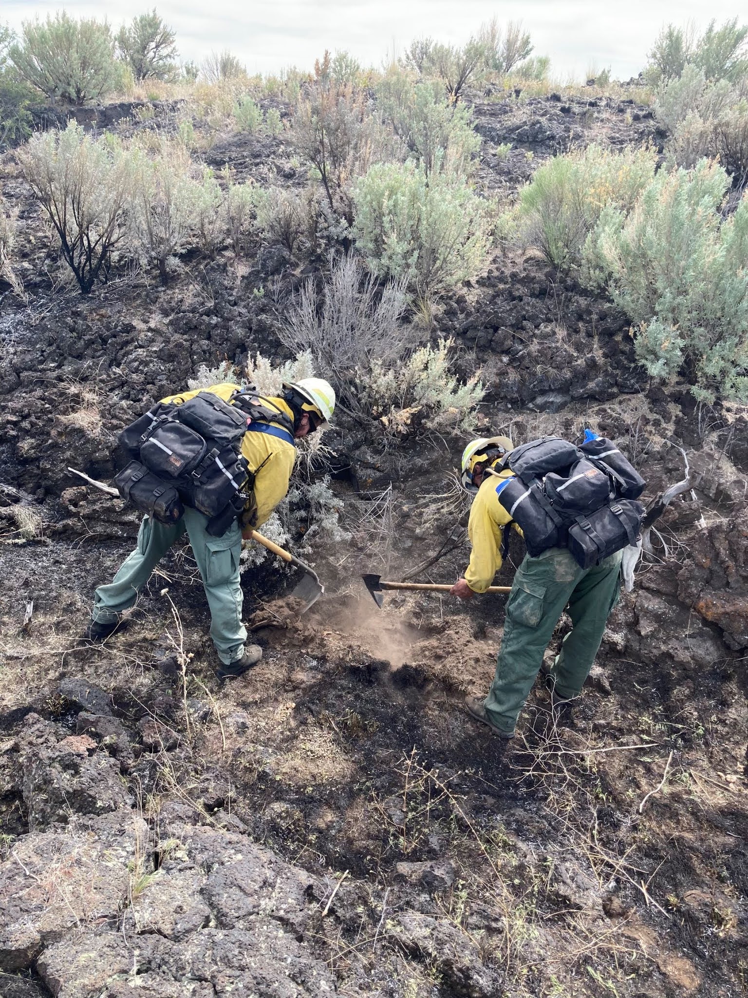
The Taber Fire, the result of an abandoned campfire, grew to 338-acres before fire crews could get a solid line around its perimeter. Firefighters responded with hand tools and bladder bags, hiking in over uneven terrain due to a lack of road access and lava rock. The Incident Commander anticipates the fire will be 100 percent contained late tonight.


“Having a fire grow to over 300 acres the first of June is not normal for this area,” said Joel Gosswiller, Idaho Falls District Fire Management Officer. “Current fire predictions, and what we are seeing on the ground, suggest this area might be busier than normal due to the anticipated hot and dry summer.” Fire managers are asking individuals to be extra cautious this summer as they recreate on public lands. Fire potential is expected to increase throughout the week as the area enters near record breaking temperatures.


The 338- acre Taber Fire was a result of an abandoned campfire. Please take precautions while enjoying your public lands. If your campfire is too hot to touch, it’s too hot to leave. Remember possessing or discharging fireworks, incendiary ammunition, steel core ammunition, and exploding targets are illegal on public lands.


Taber Fire

·   Located approximately 1-mile northwest of Taber, Idaho

·   Size: 338 acres

·   Cause: Abandoned Campfire

·   Fire resources - 4 engines, 1 dozer and a 20-person hand crew (Centennials)

·   Estimated Containment 06/01/21 at 8:00 p.m.


Indian Creek Fire

·   Located approximately 6 miles northwest of Alpine, Wyoming at the Indian Creek Boat Ramp

·   Size: 1 acre

·   Cause: Under Investigation

·   Fire resources - 2 federal engines, Swan Valley Helitack Crews, 2 Alpine Engines

·  Estimated Contained 06/01/21 at 8:00 p.m. Fire progression has stopped
Friday, August 28, 2020

Black Sand Fire burning adjacent to the St. Anthony Sand Dunes


NEWS RELEASE


For Immediate Release

Contact: EIIFC Fire Information, 208-497-5934


Black Sand Fire burning adjacent to the St. Anthony Sand Dunes

Facebook: Idaho Fire Info
(#BlackSand & #BLMIFDFire & #CTNFFire)


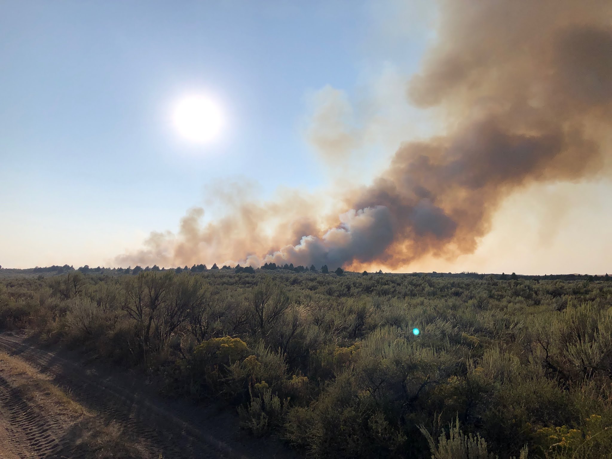
IDAHO FALLS, ID - The lightning-caused Black Sand Fire is burning approximately 6 miles northwest of St. Anthony, adjacent to the St. Anthony Sand Dunes. The fire was reported around 4:00 in the afternoon. An aggressive response from South Fremont, North Fremont, Hamer, Idaho Dept. of Lands, the Bureau of Land Management and the U.S. Forest Service helped to halt fire spread by around 8:00 p.m. this evening. Several air resources are providing support, including the VLAT (Very Large Air Tanker), which can drop 9,000 gallons of retardant in one pass.


Dozers are currently constructing fire line around the west, south and east perimeter of the fire. The St. Anthony Sand Dunes are acting as a natural containment line to the north. Firefighters are continuing to establish control lines and beginning mop up operations on hot spots. Crews will burn out pockets of unburned vegetation to prevent the fire from re-igniting and escaping containment lines.


“We had a great response from our partners tonight,” said Austin Catlin, Incident Commander. “Crews will remain on the fire this evening and well into tomorrow to continue bolstering containment lines in preparation for the anticipated wind event on Sunday.”


Start Date: 08/28/2020

Cause: Lightning

Fire Size: Estimated at 120 acres

Percent Contained: 0%. Full containment anticipated for Saturday, Aug. 28 at 6:00 p.m.

Fire Behavior: Forward progression has stopped

Fuels and Terrain: Burning in grass and brush

Fire Crews/Resources: Four engines, 2 dozers, 2 helicopters, 2 Single Engine Air Tankers (SEATs), Air Attack, 1 Lead Plan, 2 Heavy Air Tankers and 1 VLAT (Very Large Air Tanker), North Fremont County (3 engines, 2 water tenders), South Fremont County (2 engines, 1 water tender), Hamer (2 engines), Idaho Dept. of Lands (1 water tender).

Evacuations: None in effect

Closures: None, but fire officials are asking the public to stay out of the area due to high concentration of air and ground resources.

Summary: As a reminder, public lands in southeast Idaho are under Stage One Fire Restrictions.

Tuesday, August 25, 2020

Lightning storm tracks through eastern Idaho starting several small fires


Rye Grass Fire


For Immediate Release: August 25, 2020 9:00p.m.

Contact: Sarah Wheeler, sarah.wheeler2@usda.gov, 208-497-5934


Lightning storm tracks through eastern Idaho starting several small fires

Twitter: @BLMIdahoFire Facebook: Idaho Fire Info


Lightning tracked over southeast Idaho Tuesday afternoon and evening, igniting multiple small wildfires. Fire crews responded quickly to the new starts and are making great progress. Eastern Idaho Interagency Fire Center is preparing for another busy day tomorrow due to hot weather conditions and the possibility of lightning. Please take precautions while enjoying your public lands. Remember possessing or discharging fireworks, incendiary ammunition, steel core ammunition, and exploding targets are illegal on public lands. Don’t let your summer go up in smoke.

 As a reminder, eastern Idaho will enter Stage 1 fire restrictions on Aug. 28 at 12:01 a.m.

 Limekiln Fire

·   Located approximately 2 miles northwest of Stone Reservoir

·   Size: .27 acres

·   Cause: Lightning

·   Fire resources - 3 engines

·   Contained 8/25/20 at 6:45 p.m.


Miner Creek Fire

·   Located approximately 22 miles east of Blackfoot

·   Size: 400 acres

·   Cause: Lightning

·   Fire resources - 7 engines, 1 water tender and 1 dozer 

·   Contained 8/25/20 at 9:00 p.m.


Rye Grass Fire

·   Located approximately 8 miles northeast of American Falls Reservoir

·   Size: 150 acres

·   Cause: Lightning

·   Fire resources - 3 engines and 1 dozer

·   Containment unknown at this time however forward progression has stopped


Tuesday, August 18, 2020

Michaud Creek Fire Mapped at 72 Acres


NEWS RELEASE


For Immediate Release:

Contact: EIIFC Fire Information, 208-497-5934


Michaud Creek Fire Mapped at 72 Acres

Facebook: Idaho Fire Info
(#MichaudCreek & #BLMIFDFire & #CTNFFire)


IDAHO FALLS, Idaho - Firefighters expect to contain the Michaud Creek Fire by 10:00 p.m. tonight. “This area is primed to burn,” said Shane McCracken, BLM Incident Commander. “We were very fortunate to have resources that could respond quickly before the fire grew significantly.” Crews from Fort Hall, Bureau of Indian Affairs (BIA), Bureau of Land Management (BLM) and the Caribou-Targhee National Forest all responded to the incident. After the forward progression of the fire was halted, firefighters were able to obtain a more accurate acreage, mapping the fire at 72 acres.

Crews will continue to secure the right and left flanks (perimeter) of the fire and bolster dozer lines. The helicopter finished its bucket work this afternoon and will remain on standby should it be needed tomorrow. Crews will remain on scene today and tomorrow to continue mopping up hot spots near the containment lines. Interior smoke may be visible as juniper continues to burn in the fire’s interior.

Fire danger is very high in the fine, flashy fuels on BLM-managed lands and high on the Caribou-Targhee National Forest. With such extreme conditions on the ground, any ignition source could result in a wildland fire. Don’t let your summer go up in smoke and make sure you take all necessary precautions to prevent wildfires.


*Photos will be posted at Idaho Fire Info Facebook*


Michaud Creek Fire Burning Near Pocatello


Michaud Creek Fire Burning Near Pocatello

Facebook: Idaho Fire Info
(#MichaudCreek & #BLMIFDFire & #CTNFFire)


IDAHO FALLS, Idaho - The Michaud Creek Fire was reported around 10:00 a.m. approximately three miles south of the Pocatello Regional Airport in the Michaud Creek area. The fire is actively burning in grass, brush and juniper

Smoke is visible from Pocatello.

Start Date: 08/18/2020

Cause: Under investigation - fire investigators are currently on scene

Fire Size: Estimated at 100 acres

Percent Contained: 50%

Fire Behavior: Active

Fuels and Terrain: Burning in grass and brush

Fire Crews/Resources: Five engines, 3 dozers, 1 water tender, 4 Single Engine Air Tankers (SEATs) and air attack

Evacuations: None in effect

Closures: None

Summary: Dozer line is completed along a large portion of the fire. Heavy retardant is holding the north perimeter of the fire while firefighters and dozers continue to build line in the rugged terrain. With the extreme heat and dry vegetation, fire danger is extremely high in the area, particularly in fine, flashy fuels. Do your part to prevent human-caused fires. 


Monday, August 17, 2020

Stage 1 Fire Restrictions ordered for south central Idaho


News Release

August 17, 2020

                                                                                            CONTACT:

Sharla Arledge (IDL)-208-334-0233                        

Kelsey Brizendine (BLM)- 208-732-7315

Julie Thomas (Forest)-208-423-7500


Stage 1 Fire Restrictions ordered for south central Idaho


JEROME, Idaho-- As the threat of wildfire danger continues to increase, state and federal land management agencies will implement Stage 1 Fire Restrictions on lands within south central Idaho effective August 20, 2020 at 12:01 a.m. Fire restrictions are intended to decrease the chance of any preventable fires in the designated areas.

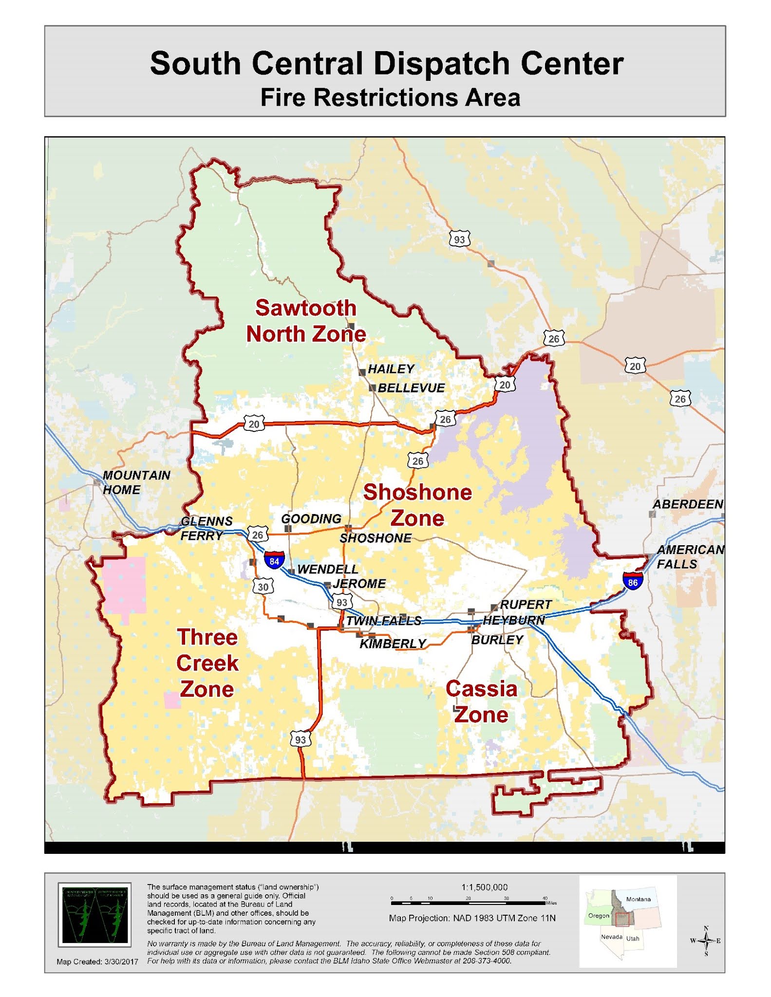
Stage 1 fire restrictions will be in place on federal, state and private forest and rangelands, roads, and trails, situated in Blaine, Camas, and Custer counties.


These restrictions are being implemented by agencies managing or providing wildland fire protection, which include the Sawtooth National Forest, Bureau of Land Management Twin Falls District, and the Idaho Department of Lands (IDL).  The following Zone is going into restrictions:


Zone 1 - Sawtooth North

All Sawtooth National Forest, Twin Falls District BLM, and Idaho State lands north of Highway 20 to the northern most Sawtooth National Forest boundary.  From Hill City east to the Craters of the Moon National Monument Park Visitor Center.

Under the Stage 1 Fire Restrictions, the following acts are prohibited on state and federally managed or protected lands, roads, and trails:

·         Building, maintaining, attending, or using a fire, campfire or stove fire except within a designated recreation site and in a permanent concrete or metal fire ring, or on private land, and only within an owner-provided structure.

·         Smoking, except within an enclosed vehicle, building, or designated recreation site, or while stopped in an area at least three feet in diameter that is barren or cleared of all flammable materials.

The following are exemptions to the Stage 1 Fire Restrictions:

·         Persons with a written permit that specifically authorizes the otherwise prohibited act.

·         Persons using fire fueled solely by liquid petroleum or liquid petroleum gas (LPG) fuels.  Such devices, including propane campfires, may be used only in an area cleared of flammable material.

·         Persons conducting activities in those designated areas where the activity is specifically authorized by written posted notice.

·         Any federal, state or local officer or member of an organized rescue or firefighting force in the performance of an official duty.

·         All land within a city boundary is exempted.

·         Other exemptions unique to each agency.


With the fire season well underway, these restrictions are intended to keep visitors to public lands safe as well as prevent dangerous and damaging wildfires. If you are planning a visit to public lands in these areas, please check with the Sawtooth Ranger District offices https://www.fs.usda.gov/sawtooth, the BLM Twin Falls District BLM https://www.blm.gov/idaho or the Idaho Department of Lands for the latest information or visit www.idahofireinfo.com.      


# # #


Sunday, July 26, 2020

Only one fire from this busy weekend still burning


EIIFC Update for Sunday 7/26/20 PM

Only one fire from this busy weekend still burning

Twitter: @BLMIdahoFire Facebook: Idaho Fire Info


Firefighters have taken the upper hand on all wildfires from this weekend. Please be mindful of your activities on public lands. Far too many wildfires occur along roadways. Common causes of roadside fires are sparks from wheel rims when tires go flat, vehicles dragging chains and hot undercarriages pulling off the road into dry grass. Be fire wise out there and don’t let your summer go up in smoke!


Kyle Canyon Fire

·   Located approximately 9 miles northeast of Howe

·   Single tree (0.1 acre)

·   Crews located and contained the fire. No further updates will be given for this fire. 


Samaria Fire

·   Located approximately 6 miles southwest of Malad

·   371 acres (helicopter mapping the size)

·   Fire resources - 4 engines, 1 bulldozer, 4 20-person handcrews, 1 single resource, 2 helicopters, 4 single engine air tankers (SEAT), air attack and a lead plane

·   Firefighters have worked hard through the day and have attained a 70% containment on this fire. Estimated contain of the fire is Monday 7/27/20 by 6:00pm. 


Pole Canyon Fire 

·   Located approximately 4 miles south of Victor

·   0.1 acre (single tree in remote forest) 

·   Fire resources - 1 engine, 1 hand crew

·   Crew hiked in and were able to contain this fire. No further updates will be given.