Social Media Picasa Youtube

Idaho Fire Incident Map

Showing posts with label Eastern. Show all posts

Monday, June 14, 2021

Eastern Idaho Interagency Fire Center Assists with Multiple Fires in Southeast Idaho


Eastern Idaho Interagency Fire Center Assists with Multiple Fires in Southeast Idaho

#ColdCreek Fire 1,200-acres and growing


Twitter: @Caribou_Targhee, @BLMIdahoFire | Facebook: @USFSCaribou-Targhee @BLMIdahoFireIdaho #GoodenoughRoad #ColdCreek


Firefighters and air resources from the Eastern Idaho Interagency Fire Center are responding to multiple fires that ignited on private lands this afternoon. Record breaking temperatures and dry fuel make for extreme fire potential. Do your part to prevent human-caused fires.


Goodenough Road Fire

·   Location and Jurisdiction: Approximately 2 ½ miles west of McCammon (private land threatening BLM)  

·   Fire Size: 25 acres

·   Cause: Human- Caused, under investigation

·   Estimated Containment: 06/14/2021 at 10:00 p.m.

·   Estimated Control: 06/15/2021 at 6:00 p.m.

·   Summary: Crews continue to mop up and look for hot spots within the fire’s interior. Two engines were released to assist with the Cold Creek Fire near American Falls


Cold Creek Fire

·   Location and Jurisdiction: Approximately 5 miles south of American Falls, Idaho (private land threatening BLM)

·   Fire Size: 1,200-acres and growing

·   Fire Behavior: Fire is running through grass, brush and juniper. Winds gusting to 20 mph.

·   Structures Threatened: Numerous structures are threatened. Multiple power lines are down and failing. Two structures are confirmed lost at this time.

·   Cause: Under investigation

·   Evacuations: Power County has issued evacuations for several areas near the fire including the Garden Road area. Evacuees can report to the American Falls High School. Contact the Sheriff’s Office at 208-226-2319 for more information.

·   Federal Fire Resources: 9 federal engines, 1 dozer, 1 air attack, 4 single engine air tankers (SEATs), 3 Heavy Air Tankers, and 1 Very Large Air Tanker (VLAT)  and lead plane. Multiple county and city resources including Power County, American Falls and others have responded.

·   Estimated Containment: None at this time

·   Summary: The Cold Creek Fire started at approximately 3:30 p.m. June 14. The fire crossed Sunbeam Road at around 7:30 p.m., moving north towards American Falls. At this time, fire officials can confirm one accident and one injury (smoke inhalation). Several powerlines are down, and the fire is threatening communication towers on Paps Mountain. Fire crews ask individuals to stay away from the area so as not to hamper firefighting operations.
Sunday, August 30, 2020

Firefighters fully suppressing two fires located near the Idaho/Wyoming border


NEWS RELEASE


For Immediate Release

Contact: EIIFC Fire Information, 208-497-5934


Firefighters fully suppressing two fires located near the Idaho/Wyoming border

Facebook: Idaho Fire Info
(#DryWaterfall #SmokyHollow #BTNF & #CTNFFire)


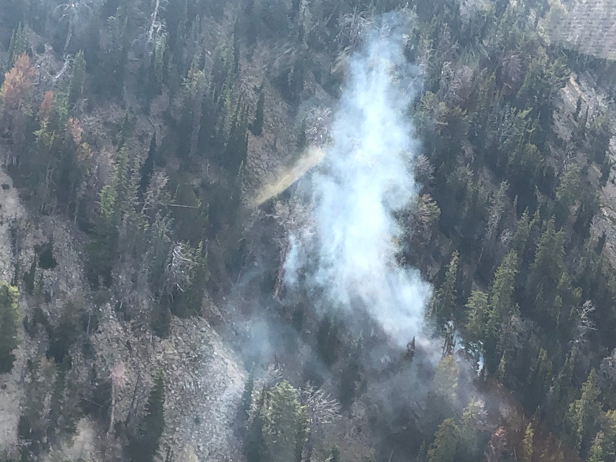
IDAHO FALLS, ID - Two fires reported Sunday morning are burning in the backcountry near the Idaho/Wyoming border. High winds and steep, rugged terrain are impeding firefighting efforts.


Dry Waterfall

·   Located near Upper Palisades Lake, 9 miles east of Swan Valley

·   Size: .1 acre

·   Cause: Lightning

·   Fire resources: Helitack Crew. Five crew members are on scene

·   Contained: 0%


Smoky Hollow

·   Located approximately 6 miles southwest of Wilson, Wyoming, just above Mosquito Creek

·   Size: 10 acres

·   Cause: Undetermined

·   Fire resources: 15 firefighters currently on scene.

·   Contained: 0%

·   The fire is burning in very steep terrain with an estimated 50% slope. Multiple falling snags and high winds are affecting firefighter’s ability to engage the fire safely. No structures are threatened. The public is asked to stay out of the area.


Black Sand Fire

·   Started: 08/28/2020

·   Located adjacent to the St. Anthony Sand Dunes

·   Size: 129 acres

·   Cause: Lightning

·   Contained: Saturday, August 29 at 10:00 p.m. This is the final update of the Black Sand Fire.


Dry Waterfall Fire

Smoky Hollow Fire

*Photos will be posted at Idaho Fire Info Facebook*


Friday, August 28, 2020

Black Sand Fire burning adjacent to the St. Anthony Sand Dunes


NEWS RELEASE


For Immediate Release

Contact: EIIFC Fire Information, 208-497-5934


Black Sand Fire burning adjacent to the St. Anthony Sand Dunes

Facebook: Idaho Fire Info
(#BlackSand & #BLMIFDFire & #CTNFFire)


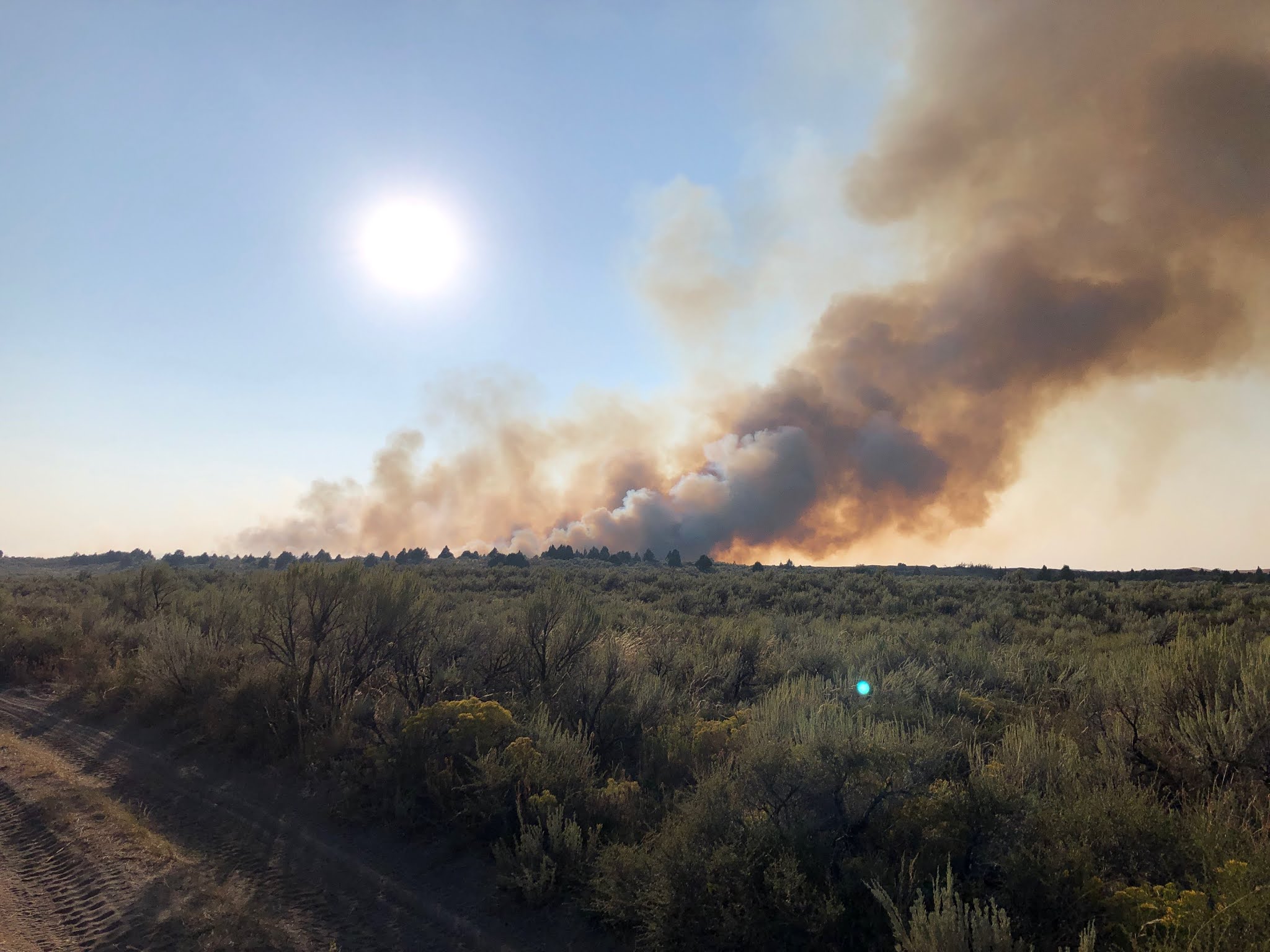
IDAHO FALLS, ID - The lightning-caused Black Sand Fire is burning approximately 6 miles northwest of St. Anthony, adjacent to the St. Anthony Sand Dunes. The fire was reported around 4:00 in the afternoon. An aggressive response from South Fremont, North Fremont, Hamer, Idaho Dept. of Lands, the Bureau of Land Management and the U.S. Forest Service helped to halt fire spread by around 8:00 p.m. this evening. Several air resources are providing support, including the VLAT (Very Large Air Tanker), which can drop 9,000 gallons of retardant in one pass.


Dozers are currently constructing fire line around the west, south and east perimeter of the fire. The St. Anthony Sand Dunes are acting as a natural containment line to the north. Firefighters are continuing to establish control lines and beginning mop up operations on hot spots. Crews will burn out pockets of unburned vegetation to prevent the fire from re-igniting and escaping containment lines.


“We had a great response from our partners tonight,” said Austin Catlin, Incident Commander. “Crews will remain on the fire this evening and well into tomorrow to continue bolstering containment lines in preparation for the anticipated wind event on Sunday.”


Start Date: 08/28/2020

Cause: Lightning

Fire Size: Estimated at 120 acres

Percent Contained: 0%. Full containment anticipated for Saturday, Aug. 28 at 6:00 p.m.

Fire Behavior: Forward progression has stopped

Fuels and Terrain: Burning in grass and brush

Fire Crews/Resources: Four engines, 2 dozers, 2 helicopters, 2 Single Engine Air Tankers (SEATs), Air Attack, 1 Lead Plan, 2 Heavy Air Tankers and 1 VLAT (Very Large Air Tanker), North Fremont County (3 engines, 2 water tenders), South Fremont County (2 engines, 1 water tender), Hamer (2 engines), Idaho Dept. of Lands (1 water tender).

Evacuations: None in effect

Closures: None, but fire officials are asking the public to stay out of the area due to high concentration of air and ground resources.

Summary: As a reminder, public lands in southeast Idaho are under Stage One Fire Restrictions.

Tuesday, August 25, 2020

Lightning storm tracks through eastern Idaho starting several small fires


Rye Grass Fire


For Immediate Release: August 25, 2020 9:00p.m.

Contact: Sarah Wheeler, sarah.wheeler2@usda.gov, 208-497-5934


Lightning storm tracks through eastern Idaho starting several small fires

Twitter: @BLMIdahoFire Facebook: Idaho Fire Info


Lightning tracked over southeast Idaho Tuesday afternoon and evening, igniting multiple small wildfires. Fire crews responded quickly to the new starts and are making great progress. Eastern Idaho Interagency Fire Center is preparing for another busy day tomorrow due to hot weather conditions and the possibility of lightning. Please take precautions while enjoying your public lands. Remember possessing or discharging fireworks, incendiary ammunition, steel core ammunition, and exploding targets are illegal on public lands. Don’t let your summer go up in smoke.

 As a reminder, eastern Idaho will enter Stage 1 fire restrictions on Aug. 28 at 12:01 a.m.

 Limekiln Fire

·   Located approximately 2 miles northwest of Stone Reservoir

·   Size: .27 acres

·   Cause: Lightning

·   Fire resources - 3 engines

·   Contained 8/25/20 at 6:45 p.m.


Miner Creek Fire

·   Located approximately 22 miles east of Blackfoot

·   Size: 400 acres

·   Cause: Lightning

·   Fire resources - 7 engines, 1 water tender and 1 dozer 

·   Contained 8/25/20 at 9:00 p.m.


Rye Grass Fire

·   Located approximately 8 miles northeast of American Falls Reservoir

·   Size: 150 acres

·   Cause: Lightning

·   Fire resources - 3 engines and 1 dozer

·   Containment unknown at this time however forward progression has stopped


Tuesday, August 18, 2020

Michaud Creek Fire Mapped at 72 Acres


NEWS RELEASE


For Immediate Release:

Contact: EIIFC Fire Information, 208-497-5934


Michaud Creek Fire Mapped at 72 Acres

Facebook: Idaho Fire Info
(#MichaudCreek & #BLMIFDFire & #CTNFFire)


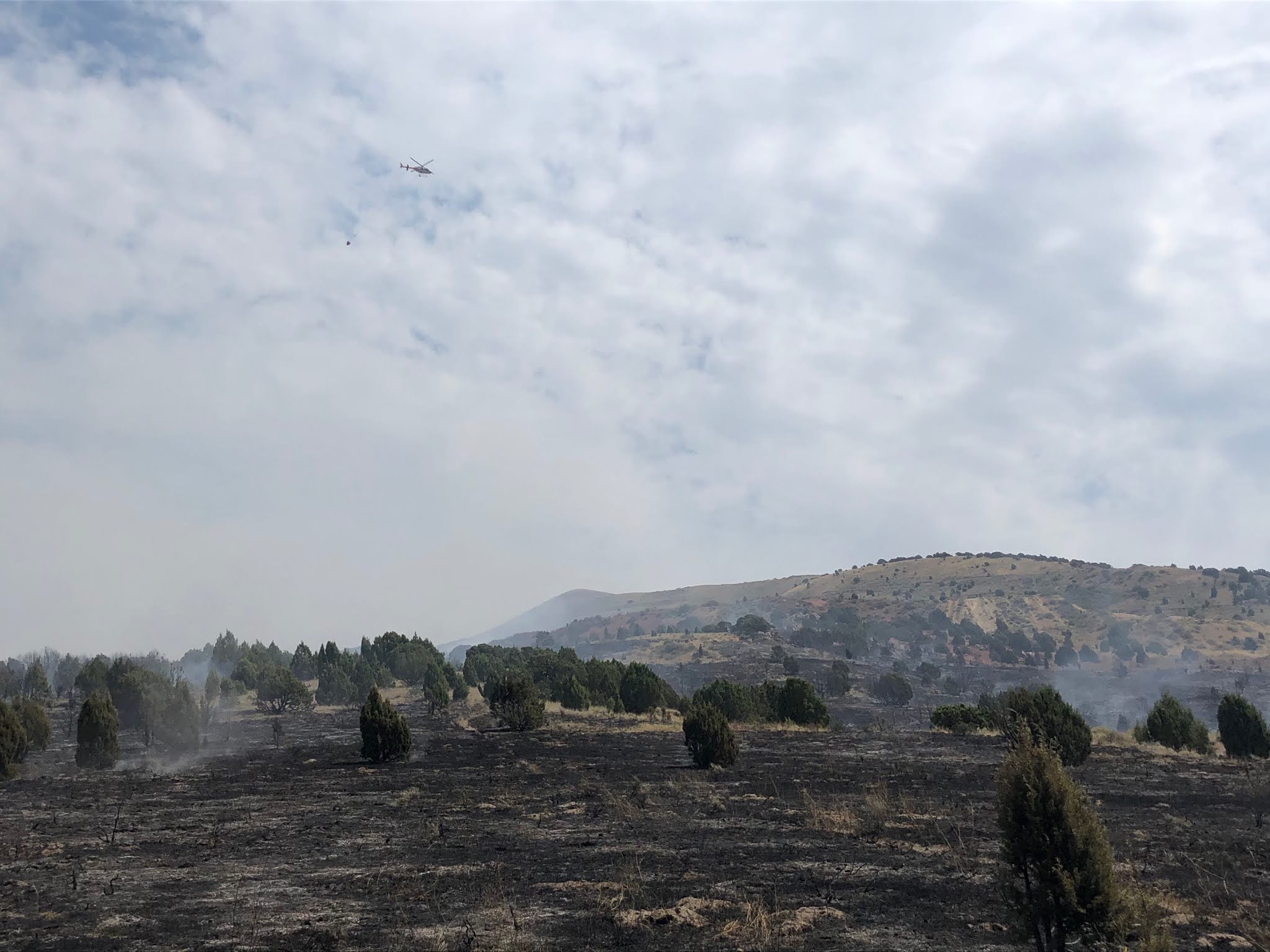
IDAHO FALLS, Idaho - Firefighters expect to contain the Michaud Creek Fire by 10:00 p.m. tonight. “This area is primed to burn,” said Shane McCracken, BLM Incident Commander. “We were very fortunate to have resources that could respond quickly before the fire grew significantly.” Crews from Fort Hall, Bureau of Indian Affairs (BIA), Bureau of Land Management (BLM) and the Caribou-Targhee National Forest all responded to the incident. After the forward progression of the fire was halted, firefighters were able to obtain a more accurate acreage, mapping the fire at 72 acres.

Crews will continue to secure the right and left flanks (perimeter) of the fire and bolster dozer lines. The helicopter finished its bucket work this afternoon and will remain on standby should it be needed tomorrow. Crews will remain on scene today and tomorrow to continue mopping up hot spots near the containment lines. Interior smoke may be visible as juniper continues to burn in the fire’s interior.

Fire danger is very high in the fine, flashy fuels on BLM-managed lands and high on the Caribou-Targhee National Forest. With such extreme conditions on the ground, any ignition source could result in a wildland fire. Don’t let your summer go up in smoke and make sure you take all necessary precautions to prevent wildfires.


*Photos will be posted at Idaho Fire Info Facebook*


Michaud Creek Fire Burning Near Pocatello


Michaud Creek Fire Burning Near Pocatello

Facebook: Idaho Fire Info
(#MichaudCreek & #BLMIFDFire & #CTNFFire)


IDAHO FALLS, Idaho - The Michaud Creek Fire was reported around 10:00 a.m. approximately three miles south of the Pocatello Regional Airport in the Michaud Creek area. The fire is actively burning in grass, brush and juniper

Smoke is visible from Pocatello.

Start Date: 08/18/2020

Cause: Under investigation - fire investigators are currently on scene

Fire Size: Estimated at 100 acres

Percent Contained: 50%

Fire Behavior: Active

Fuels and Terrain: Burning in grass and brush

Fire Crews/Resources: Five engines, 3 dozers, 1 water tender, 4 Single Engine Air Tankers (SEATs) and air attack

Evacuations: None in effect

Closures: None

Summary: Dozer line is completed along a large portion of the fire. Heavy retardant is holding the north perimeter of the fire while firefighters and dozers continue to build line in the rugged terrain. With the extreme heat and dry vegetation, fire danger is extremely high in the area, particularly in fine, flashy fuels. Do your part to prevent human-caused fires. 


Thursday, July 9, 2020

Telegraph Fire Contained on July 9


IDAHO FALLS, Idaho - Fire officials called the Telegraph Fire 100 percent contained July 9 at 8:00 p.m. Crews will begin transitioning off the fire tomorrow night, with a skeleton crew remaining on scene for the next few days monitoring for any hot spots.

Wildland firefighters use the terms contained and controlled to define a fire’s status. A fire is considered contained when a fuel break around the fire has been completed and can reasonably be expected to stop the fire’s spread. The fire may still be burning but not likely to spread. Controlled means the fire has not only been contained, but any hot spots threatening the line have been mopped up and interior heat is far enough away from the containment lines that it is not a threat to any further spread. Large fires can be in a “control” status for weeks before officially being called “out.”

Motorists are responsible for many of the wildfires sparked along our roadways. Nearly all these fire starts could be prevented by following these safety rules:

Secure Chains. Practice safe towing. Dragging chains throw sparks. Always use appropriate safety pins and hitch balls to secure chains.

No Dragging Parts. Make sure your vehicle is properly maintained, with nothing dragging on the ground.

Check Tire Pressure. Maintain proper tire pressure. Driving on exposed wheel rims will throw sparks.

Carry a Fire Extinguisher in your Vehicle and Learn How to use it. Don’t drive your vehicle onto dry grass or brush. Hot exhaust pipes and mufflers can start fires that you won’t see—until it’s too late!

Properly Maintain Brakes. Brakes worn too thin may cause metal to metal contact, which can cause a spark.

Wednesday, July 8, 2020

Multiple Fires Erupt Along Highway 20


IDAHO FALLS, Idaho - Firefighters are responding to several fire starts along Highway 20, approximately 20 miles west of Idaho Falls. Fire investigators are en route.

Telegraph Fire: Located approximately 20 miles west of Idaho Falls, the Telegraph Fire is running through sagebrush and grass. The fire is approximately 700 acres. Seven engines from the Idaho National Laboratory and Eastern Idaho Interagency Fire Center are on scene along with four dozers, air attack, four single engine air tankers (SEATs) and one type three helicopter. Crews are making good progress and the engines and dozers are engaging both flanks (sides) of the fire. The fire is operating under unified command with joint incident commanders from the INL and Bureau of Land Management (BLM). Moderate winds are pushing the fire northeast but are anticipated to dissipate this evening. Incident Commander Farron Kunkel states that firefighters will work late tonight to complete a line around the fire and stop forward spread.

Corral Fire: Approximately 20 miles west of Idaho Falls. Crews from the City of Idaho Falls and INL have stopped the spread of Corral Fire and are currently mopping up. Fire officials anticipate this fire will be contained at 9:00 p.m. tonight.


Monday, May 18, 2020

Caribou-Targhee National Forest hiring for 2020 seasonal firefighters


Caribou-Targhee National Forest hiring for 2020 seasonal firefighters
Job postings close May 26

Idaho Falls, ID - The Caribou-Targhee National Forest is hiring a second round of seasonal wildland firefighters for the 2020 fire season. Job applications will be accepted until May 25 through www.usajobs.gov.

“Working as a wildland firefighter is a very rewarding and challenging job,” said Martell Gibbons, Assistant Forest Fire Management Officer. “We are always looking for hard-working, physically fit individuals to join our team.” This year the forest has approximately 10 additional seasonal positions they are looking to fill.

Pay starts at $12.33 with the opportunity for overtime and hazard pay. To qualify you must be 18 years of age, a U.S. citizen and have a valid driver’s license. Positions range from engine crew members to helitack crew members. Learn more about wildland fire positions on our website at: https://www.fs.usda.gov/main/ctnf/about-forest/jobs.

Duty stations are available in Montpelier, Soda Springs, Malad, Pocatello, Driggs, Swan Valley, Ashton, Island Park and Dubois. We strongly encourage those interested in applying to contact the local duty station prior to submitting their application.

Portneuf Zone (Malad and Pocatello): Dan Bartel, 208-236-7513, Daniel.bartel@usda.gov
Henry’s Fork Zone (Ashton, Island Park and Dubois): Jeff Hill, 208-652-1205, jeff.hill@usda.gov
South Fork Zone (Driggs and Swan Valley): Spencer Johnston, 208-523-1412, spencer.johnston@usda.gov
Bear River Zone (Soda Springs and Montpelier): Garth Alleman, 208-847-0375, garth.alleman@usda.gov

For more information on the Caribou-Targhee National Forest visit http://www.fs.usda.gov/ctnf.

Thursday, April 23, 2020

Caribou-Targhee National Forest Hiring for Fire Hire - Closes May 6


The Caribou-Targhee National Forest will soon hire the following permanent positions: Engine, Handcrew, and Prevention Tech positions during the 2020 Region 4 Spring Fire Hire. These positions will be advertised using the direct hiring authority. Applicants will be limited to applying at two duty locations. Permanent FIRE position announcements can be found at www.usajobs.gov.

For job-specific information and contacts, please go to https://www.fs.usda.gov/main/ctnf/home.

Tuesday, December 10, 2019

Soda Hills Prescribed Hand Pile Burn


SODA SPRINGS, Idaho- The BLM Idaho Falls District will be burning 25 acres of hand piles in Soda Hills approximately 4 miles northwest of Soda Springs, Idaho on December 10 and 11 2019. Smoke may be visible from Soda Springs or Highway 30. This project reduces the wildland fire hazard and reduces potential negative effects from future wildland fire to federal and adjacent private lands. While also improving forest health and restoring fire adaptive ecosystems. #BLMIFDFire #RxFire