Social Media Picasa Youtube

Idaho Fire Incident Map

Showing posts with label Rx Fire. Show all posts

Monday, January 28, 2019

Prescribed Burning South of Burley, ID.


The Idaho Department of Lands will be conducting a pile burning project approximately 40 miles south of Burley, ID in the Jim Sage Mountains.  Burning will begin on Wednesday, January 30th and continue through Friday, February 1st.  The project will burn roughly 1700 piles of juniper that were cleared as part of a Cohesive Strategy Special Project that was grant funded  by the US Forest Service through the Idaho Department of Lands.  The project is located in two different units; one unit is approximately 4 miles east of Elba, ID, and the other is approximately 4 miles south-southwest of Almo, ID


The intention of the fuels treatment is to reduce juniper density to improve sage grouse habitat and create fuel breaks to protect existing sage habitat. 

Monday, March 26, 2018

BLM to conduct prescribed burn in southwest Idaho


BOISE, Idaho - The Bureau of Land Management will soon conduct the Pole Creek Jackpot Prescribed Burn, located approximately 35 miles southeast of Jordan Valley, Oregon, on the western flanks of Juniper Mountain. Expected to take place during the first two weeks of April, ignitions will occur for two to three days with subsequent mop-up and patrol continuing for several days after.

This 2,500-acre burn will target piles of heavy, dead fuels that have accumulated from previous western juniper thinning projects, but not the surrounding live vegetation. This is part of an effort to protect the sage-steppe landscape that supports traditional land uses and serves as important habitat for wildlife.

The exact timing of this burn is subject to weather, fuel and ground conditions.

For more information, contact the BLM Boise District at (208) 384-3210

Monday, May 1, 2017

Spring Prescribed Burning Planned on the Nez Perce-Clearwater National Forests

Kamiah, Idaho (May 1, 2017) - The Nez Perce-Clearwater National Forests will be conducting prescribed burns throughout the forest this spring as weather allows.  Roads and trail heads that lead into these areas will be posted with caution signs and a map of the prescribed fire locations. 
Prescribed burning is done to reduce dead and down fuels, selectively thin understory trees in densely forested stands, stimulate fire tolerant plant species, enhance forage for wildlife, reduce the risk of large-scale stand-replacement fires, create strategic fuels breaks in the urban interface, and bring back fire’s natural role to the landscape.

Prescribed fire activities involves risk and fire managers evaluate values at risk prior to ignition.   Firefighter and public safety are our highest priorities.  This applies to all hazardous environments, and to the concept that we incur risk if we burn and if we do not burn. Fire is a part of the environment in this fuel type and a natural process that will occur regardless if it is a managed burn or unplanned wildfire. 

Prior to conducting a prescribed fire many values at risk are considered and include firefighter and public safety, cumulative affects to communities, neighboring jurisdictions and private lands, natural resources (either in the loss of habitat due to removal of fire or devastation of habitat when a wildfire of much higher severity then a prescribed burn occurs), and other resources such as state and local firefighters, EMTs, aerial resources, etc.

Burning in the spring is also an important way of reducing the amount of smoke that typically impacts communities during the fire season.  Smoke from these prescribed fires will be much less than what would be expected from a wildfire.  If smoke concentrations approach air quality standards fire ignition may be delayed until air quality improves.  Residual smoke may be visible for up to 2 weeks following ignition, but most of the smoke from the fires will dissipate 1-2 days.

The following burn projects are associated with past timber harvests. The general objective for these units would be to reduce residual fuel loadings created as a result of the commercial harvest operations. These burns will generally be shorter duration and more localized in nature.


Lochsa/Powell Ranger District - 316 acres are planned:
·         White White Timber Sale - 300 acres,1 mile southeast of Musselshell Work Center
·         Saddle Camp Timber Sale - 16 acres, along Forest Service road 5601
Moose Creek Ranger District - 350-400 acres are planned:
·         Iron Mountain Timber Sale - 350-400 acres, 10 miles south of the Fenn Ranger Station along Forest Service road 464
North Fork Ranger District - 75 acres are planned:
·         Middle Bugs Timber Sale - 75 acres in the Lean-to-Ridge area
Palouse Ranger District - 140 acres are planned:
·         Robo-Stew Timber Sale - 63 acres, 0.8 miles west of Elk River, adjacent to Hwy 8
·         Robo-Stew Timber Sale - 16 acres, 1.8 miles southwest of Elk River near Forest Service road 1452
·         Robo-Stew Timber Sale - 14 acres, 1.3 miles south southeast of Elk River near the Dent road
·         Abes Animal Timber Sale - 47 acres, 4.1 miles northwest of Bovill on Forest Service road3321
Red River Ranger District - 630 acres are planned:
·         French Gulch Timber Sale - 93 acres, 5 miles southeast of Elk City
·         Trapper John Timber Sale - 152 acres, 12 miles south of Elk City
·         Jungle Trail Timber Sale - 216 acres, 10 miles southeast of Elk City
·         South Township Timber Sale - 169 acres along the south border of the Elk City Township
Salmon River Ranger District - 331 acres are planned:
·         Buckshot Timber Sale - 162 acres located in the Slate Creek Drainage approximately 10 miles Northwest of Slate Creek, Idaho
·         Moonshine Timber Sale - 103 acres, Located along FSR 9315 and 9316  in Little Slate Creek drainage approximately 12 miles southeast of Slate Creek, Idaho
·         Millertime Timber Sale - 66 acres, located along FSR 9413 and in the Little Slate Creek and Van Buren Creek drainages
In addition to activity associated with timber harvest, the Salmon River Ranger District plans to burn 2,000-4,000 acres of natural fuels in the Kessler, Blue Mountain, Monument, Wickiup, Blue Ridge, and Blacktail drainage areas.

Specific information on the location and timing of these prescribed burns are available at each of the district offices.  Powell Ranger Station - Matt Young or Brandon Cichowski, 208-942-3113, Moose Creek Ranger District - Tim Schaeffer or Jon Norman, 208-926-4258, Lochsa Ranger Station - Sean Gaines or Neal Cox, 208-926-4274, North Fork Ranger District - Brandon Skinner or TC Peterson, 208-476-4541, Palouse Ranger District - Lisa Spinelli or Alan Carlson, 208-875-1131, Salmon River Ranger District - Richard Stiles or Kevin Barger, 208-983-1950, Red River Ranger District - Josh Bransford or Tom McLeod, 208-842-2245.

Monday, September 12, 2016

Fall Burning Planned on the Nez Perce-Clearwater National Forests

Kamiah, Idaho (September 9, 2016) - The Nez Perce-Clearwater National Forests will be conducting fall prescribed burns beginning as early as Saturday, September 10, 2016, and continuing through September and into October until weather or air quality conditions are no longer favorable.  Roads and trail heads that lead into these areas will be posted with caution signs and a map of the prescribed fire locations. 

Powell Ranger Station is planning to broadcast burn a 20 acre unit in the Saddle Camp area along FS road 5601.  Smoke may be seen along FS road 107 and FS road 500.

Machine piles in the Saddle Camp and Granite Pass areas within the vicinity of the Powell Divide Timber Sale, along with hand piles near Rocky Point Lookout and the Powell Ranger Station, are also targeted for burning.

Moose Creek Ranger District is planning pile burning in the Johnson Bar area and the Swiftwater and Iron Mountain timber sale areas.  As weather and conditions allow prescribed fire treatments may be applied to 3 units in the O’Hara area.  Visitors may see smoke and meet forest personnel along FS roads 470 (Coolwater) and FS road 464 (O’Hara) during burn operations.

Lochsa Ranger Station as part of the North Lochsa Face Project is planning a landscape burn in the Middle Butte area north of FS road 483.  The prescribed fire treatment is estimated to be 1,000 acres.  The purpose of the burn is to reintroduce fire to the landscape, reduce woody fuel loadings which also reduces the potential for large, catastrophic wildfires, and allow vegetation, naturally found in these areas, to return.

Additional broadcast burning is planned in late September or early October in the Dead Canyon Timber Sale area near the upper portion of Deadman Creek and Cedar Knob and in the Cabin Timber Sale area near Cabin Creek.  The prescribed fire treatments will reduce woody debris to create openings for tree planting.

North Fork Ranger District is planning pile burning in the Middle Bugs Timber Sale area.  Piles are located near Lean-To Ridge off of FS road 555 and Beaver Dam Saddle off of FS road 103.

Palouse Ranger District is planning to broadcast burn 30 acres in the Abes Animals Timber Sale near Bovill and an additional 15 acres in the Robo Stew Timber Sale near the community of Elk River. 

Machine piles will be burned in the Cherry Pit, located near Helmer, and Abes Animal timber sale areas.    Hand piles located near Jerome Creek, near Harvard, and near the Palouse Ranger District are also targeted for burning. 

Salmon River Ranger District is scheduled to broadcast burn approximately 336 acres within the Festus, Adams Stewardship and the Buckshot timber sale areas.

Approximately 129 acres will be treated within the Festus Timber Sale southeast near White Bird Station off of FS road 9485.

45 acres located in two logging units within the Adams Stewardship Timber Sale near the Adams Work Center, FS road 221, and FS road 309.

Treatments in the Buckshot Timber Sale will total 162 acres and is located near Willow Flat off of FS road 354.

Prescribed fire treatments in various Ponderosa Pine plantations near McComas Meadows, Earthquake Basin, and in the Cove area at the head waters of Bully Creek are planned.  200-300 acres will be treated.

Red River Ranger District, weather permitting, will begin prescribed fire treatments September 12, 2016 and continue until weather and conditions no longer support burning operations.  Prescribed fire treatments are scheduled in the Red River Meadows area and the Soda Creek area. 

Acres and locations scheduled include:  Approximately 100 acres in the 66 Timber Sale located on the west side of Red River Meadows and below FS road 1800 (Cole Porter Road), 80 acres, Looney 2 Timber Sale, east of FS road 222 along FS road 1806 (Loon Creek Road), 14 acres, Blanco Timber Sale, east of FS road 222 and north of FS road 1183 (Blanco Road), 100 acres, Jungle Trail Timber Sale, located between FS road 234 (Red River Hot Springs Road) and FS road 1172 (Soda Creek Road), and 200 acres in the French Gulch Timber Sale along FS road 9822 (French Gulch Road).

Fire personnel will work closely with the Idaho/Montana Airshed Group, the National Weather Service, and the Idaho Department of Environmental Quality to insure that smoke impacts are minimized. 

Smoke from these prescribed fires will be much less than what would be expected from a wildfire.  If smoke concentrations approach air quality standards fire ignition may be delayed until air quality improves.  Residual smoke may be visible for up to 2 weeks following ignition, but most of the smoke from the fires will dissipate 1-2 days after ignition.

Specific information on the location and timing of these prescribed burns are available at each of the district offices.  Powell Ranger Station - Matt Young or Brandon Cichowski, 208-942-3113, Moose Creek Ranger District - Tim Schaeffer or Aaron Skinner, 208-926-4258, Lochsa Ranger Station - Sean Gaines or Neal Cox, 208-926-4274, North Fork Ranger District - Mike Lubke or TC Peterson, 208-476-4541, Palouse Ranger District - Lisa Spinelli or Alan Carlson, 208-875-1131, Salmon River Ranger District - Mike Blinn or Kevin Barger, 208-983-1950, Red River Ranger District - Josh Bransford or Tom McLeod, 208-842-2245.

Tuesday, August 23, 2016

East Cinder Prescribed Fire- CORRECTED


The dates of the East Cinder Prescribed Fire, scheduled from August 23- 31, have been changed to September 1- October 15. This change is due unfavorable weather conditions. The location and objectives of the prescribed fire remain the same. For questions regarding this change, please contact Kelsey Brizendine of the Twin Falls District BLM at (208) 732-7315.

East Cinder Prescribed Fire to Take Place August 22-31
Objective is to Reduce Risk of Large Fires and Enhance Wildlife Habitat

            SHOSHONE, ID - The Bureau of Land Management (BLM) Twin Falls District will conduct a prescribed fire in the Cinder Butte area northeast of Hazelton, Idaho, Aug. 22-31, if the weather is favorable.  The East Cinder prescribed fire is expected to take three to four days of ignitions, with an additional one to two days to monitor and patrol after the prescribed fire has been completed.

            The project will reduce the risk of large fires and the resulting conversion of sagebrush habitat to invasive annual grasses and weeds. The burn will also enhance wildlife habitat, restore native grasses and shrubs and increase public safety. 

            There may be some smoke that settles east of the project in the evenings, but the majority of the smoke is expected to lift and move off to the northeast.  If you have any questions, please contact Kelsey Brizendine of the Twin Falls District BLM at (208) 732-7315.


East Cinder Prescribed Fire to Take Place August 23-31


East Cinder Prescribed Fire to Take Place August 23-31
Objective is to Reduce Risk of Large Fires and Enhance Wildlife Habitat

            SHOSHONE, ID - The Bureau of Land Management (BLM) Twin Falls District will conduct a prescribed fire in the Cinder Butte area northeast of Hazelton, Idaho, Aug. 23-31, if the weather is favorable.  The East Cinder prescribed fire is expected to take three to four days of ignitions, with an additional one to two days to monitor and patrol after the prescribed fire has been completed.

            The project will reduce the risk of large fires and the resulting conversion of sagebrush habitat to invasive annual grasses and weeds. The burn will also enhance wildlife habitat, restore native grasses and shrubs and increase public safety. 

            There may be some smoke that settles east of the project in the evenings, but the majority of the smoke is expected to lift and move off to the northeast.  If you have any questions, please contact Kelsey Brizendine of the Twin Falls District BLM at (208) 732-7315.

Tuesday, June 21, 2016

BLM Plans Prescribed Fire in Cinder Butte Area - Project expected to reduce risk of large fires

The Twin Falls District Bureau of Land Management (BLM) plans to conduct a prescribed fire in the Cinder Butte area northeast of Hazelton anywhere from June 24 through July 30, depending on weather conditions. This project is expected to take three to four days of ignitions, with an additional one to two days to monitor and patrol after the fire has been completed.
The objective of the East Cinder prescribed fire is to reduce the risk of large fires and the subsequent conversion of sagebrush habitat to invasive annual grasses and weeds. The burn will also enhance wildlife habitat, restore native grasses and shrubs, and increase public safety.
There may be residual smoke that settles east of the project in the evenings, but the majority of the smoke will lift and move to the northeast. For more information, please contact Ryan Berlin, Twin Falls District Fire Information Officer, at (208) 312-1697.

Monday, April 4, 2016

Joint exercise between Twin Falls BLM Fire and Bliss Rural Fire Department Partners

On Saturday, March 26, Bliss Rural Fire Department (RFD) and Twin Falls Fire and Aviation (TFD) personnel conducted a joint exercise to help reduce hazardous tumble weed accumulation around a residential home.  

For several years tumble weeds have blown in and accumulated on public land adjacent to the private residence. Bliss Fire Chief, Levi Diehl, contacted the TFD and requested assistance to remove the tumble weeds that were posing a potential wildfire hazard.  

TFD fire personnel prepped the RX burn area, by raking the tumble weeds away from the fence, before igniting the two acre area to remove the hazardous fuel.  Bliss RFD provided two Type IV engines and several fire fighters to provide structure protection on the private property during ignition on BLM ground.


“This project was a perfect opportunity to conduct a joint exercise between BLM and our Bliss Rural Fire Department partners,” said Jake Williams RX Burn Boss Trainee. 

Monday, March 7, 2016

Boise Bureau of Land Management Prescribed Fire 2016

BOISE, ID - The Boise District Bureau of Land Management (BLM) Fire and Fuels program is planning several prescribed burns later this winter and spring of 2016. There are three projected burns at this time. The objectives of these projects are watershed research and reducing both hazardous fuel loading and the encroachment of juniper in the sage-steppe ecosystem.

Fence-line Prescribed Burn - The Fence-line Prescribed Burn is located in the Morley Nelson Snake River Birds of Prey National Conservation Area south of Boise. This project could begin as early as February and last until May depending on fuel conditions, tumbleweed accumulations and weather. The burning is targeted at hazardous accumulations of tumbleweeds along fence lines and roadways that create hazards to the public. Approximately 200 acres of hazardous fuels will be targeted but more may be treated depending on the accumulation of hazardous fuels throughout the spring. Fire managers will wait for seasonal conditions such as green grass or snow adjacent to the tumbleweed accumulations before they begin with the project. These natural barriers allow firefighters to burn only the hazardous fuels along roadways and fence lines with little chance of fire spreading outside of those areas. The public can expect to see smoke in the air from some distance, as well as fire apparatus on roadways and possible short-term travel delays on secondary roads due to smoke. To provide for the safety of both the public and firefighters, the BLM coordinates flagging on roadways during burning with Elmore County, Ada County and the Idaho Department of Transportation.

South Mountain Prescribed Burn, Black-lining - The South Mountain prescribed burn is located 21 miles southeast of Jordan Valley, Oregon, in Owyhee County and is 196 acres in size. This project will be conducted in partnership with the U.S. Department of Agriculture, Agriculture Research Service and private landowners to study hydrological impacts of juniper encroachment. Each watershed will be pretreated one year prior to burning by cutting and/or slashing the western juniper in the unit with chainsaws. The watershed will then be burned in the fall or the next year after pretreatment to allow the cut fuels to cure out. To allow for the safety of firefighters and to reduce the risk of escape, the unit’s perimeters will be “black-lined” the spring before the unit is scheduled to be burned. This practice occurs in the spring when fuel moistures in surrounding fuels are high and grass has begun to grow, allowing firefighters to utilize these natural barriers to contain the fire. A 50-foot to 100-foot-wide strip is ignited around the perimeter to burn heavy concentrations of felled juniper that exist adjacent to the control lines. The strip will provide a safety buffer for firefighters who return in the fall to burn the entire unit. The public may see smoke on the south flanks of South Mountain March through May, depending on weather and fuel conditions. Ignitions are expected to take one day to complete with mop-up and patrol of the fire for several days after.

Pole Creek Jackpot Prescribed Burn - The Pole Creek Jackpot Prescribed Burn is located 35 miles southeast of Jordan Valley, Oregon, in Owyhee County on Juniper Mountain. The fire is 1,400 acres in size and will involve “jackpot” prescribed burning aimed at reducing concentrations of heavy fuels from past juniper-cutting treatments. This treatment will allow only the concentration of fuels created by cutting juniper to be burned and not the surrounding vegetation. Fire managers will look for weather and fuel conditions that will slow the spread of fire outside of cut juniper areas, including snow on the ground, high fuel moisture or new grass growth acting as a natural barrier. Burn patches will normally be confined to the individual tree debris zone and will be less than two acres, though some larger patches may also occur. The burn is expected to take place between February and March, with ignitions of the unit taking two to five days and subsequent mop-up and patrol of the fire for several days. The public can expect to see smoke on the western flanks of Juniper Mountain during ignitions and for several days afterwards.

For more information about these prescribed burn projects contact Josh Renz at 208-384-3300.

Monday, November 2, 2015

Lowman Ranger District of Boise National Forest to Begin Pile Burning


Lowman, Idaho - Beginning Monday, November 02, 2015, fire staff will be burning piles at multiple locations across the Lowman Ranger District of the Boise National Forest. Prescribed burning is limited to the ignition of hand piles, landing piles, and debris piles. This effort is expected to occur over the next couple of weeks. Ignition is likely to occur in the following areas:

·         Rock Creek (594 road)
·         Long Creek Summer Homes (545 road)
·         Long Creek unit 264A (545 road)
·         Cache Creek
·         Lowman district office
·         Elk Creek guard station
·         Tennessee Creek dispersed site
·         Bear Valley area
·         Grandjean area

Friday, October 30, 2015

Idaho Falls District BLM to Conduct Prescribed Burns

The Idaho Falls District Bureau of Land Management (BLM) plans to conduct multiple prescribed burns in eastern Idaho this fall as weather and fuel conditions allow.  The project areas vary in scope and purpose, but aspen regeneration is common to many of them.  Aspen regenerate via root suckers and thrive on disturbance to spur new growth.  They also require abundant sunlight which is often inhibited by overgrowth and conifer encroachment in the absence of natural fire occurrence.  Depending upon weather conditions, burning is expected to begin Monday, Nov. 2 and continue throughout the month.  Fire managers must operate within a pre-identified margin of conditions to achieve the best results.

The BLM will be conducting prescribed fire operations in the following project areas:

Ninemile - Northeast of Downey, Idaho, the 85-acre project area is composed of juniper and Douglas fir slash piles created by both hand and machinery.  The intent is to improve the Downey watershed and protect it from a potentially devastating fire incident.

Soda Hills - A total of about 25 acres will be burned in the heads of 90% Canyon and Idaho Ranch Canyon, north and west of Soda Springs, Idaho.  Machine piles at 90% Canyon will be burned as part of a timber sale cleanup to reduce downed fuels on the rangeland.  Hand piles in Idaho Ranch Canyon are being treated to reduce conifer encroachment and encourage aspen regeneration.

Patelzick Creek - About five miles west of Spencer, within the southern foothills of the Beaverhead Mountain Range, the Patelzick Creek Aspen Health Project consists of about 35 acres of piles that were created following a thinning treatment that occurred in the summer of 2014.  This thinning was done in response to the overpopulating of aspen stands and an adjacent spring complex by encroaching conifers.  If left untreated, these conifers would have outcompeted the remaining aspen.  The goal of the treatment is to improve wildlife habitat, stimulate aspen growth and increase soil moisture and spring output. 
 
Follow us on Twitter:  @BLMIdahoFire using #BLMIFDFire.

Friday, October 16, 2015

CTNF Prescribed Fire Update


Fall Creek Prescribed Fire

16 October 2015

The Caribou-Targhee National Forest has treated 127 acres over the past two days on the Fall Creek Prescribed Fire.  Most of this work was done by hand, with firefighters using drip torches to ignite the fuels.  Today, a helicopter from the Bridger-Teton National Forest will be utilized to light additional acreage with a helitorch.  With the weather expected to remain favorable, firefighters will continue to work through the weekend to achieve the best results on the project area prior to the arrial of cooler and moist weather conditions. 

Tuesday, October 13, 2015

Prescribed Burning on the Caribou-Targhee National Forest

Fall Creek Prescribed Fire Unit

 
The project area is located in the Caribou Mountains at the head of the Fall Creek drainage approximately 13 miles southwest of Swan Valley, Idaho.  The primary purpose of this project is to utilize mechanical slashing and prescribed fire to treat the declining aspen population and mature mountain brush species.  These treatments will create a diversity of age classes within winter and summer range identified for big game and numerous other wildlife species.  The secondary purpose of the project is to reduce hazardous fuels within the project area.  Hazardous fuels reduction will increase public safety by making the area more defensibly from potential wildfires in the future.

The implementation of this burn is expected to take two to three days based upon current fuel and weather conditions.  Minimal smoke impacts are expected for the Swan Valley area; however, hunting in the vicinity may be affected by fire activity.  Following ignition operations, the project area will be patrolled and monitored until the burn can be declared completely out.  


 The Rocky Mountain Elk Foundation (www.rmef.org) and Idaho Fish and Game (www.fishandgame.idaho.gov) have partnered with the Caribou-Targhee National Forest to complete this project. 
 

Tuesday, October 6, 2015

Fall Burning Program to Start in Early October on the Boise National Forest

With the fall season cooler temperatures, Boise National Forest fire managers plan to start their annual fall prescribed burning program of nearly 3000 acres this year which could last for several weeks depending on weather and fuel conditions. 

Fire crews anticipate favorable weather conditions by early October, allowing them to ignite low-intensity prescribed fires that reduce potential wildfire fuel, improve wildlife habitat, and reduce threats to nearby communities.

Specific information is available by contacting the local ranger districts, the Boise National Forest Headquarters at 208-373-4100, on the web at www.rxfire.com, or by calling the prescribed fire hotline at 208-373-4208. 

Fire officials strongly advise hunters and other outdoor enthusiasts to determine the location and anticipated times of burns before leaving their homes. 

Fire personnel will attempt to contact people who might be hunting or recreating in an area before a planned ignition.  Recreating public impacts are anticipated to be very minimal. 

Lowman Ranger District (1,091 acres):
  • Sam’s Pine (500 acres) located about 10 miles northwest of Lowman will be ignited using a helicopter to reduce fuels and restore the area. 
  • Bear Creek (500 acres) about 20 air miles east of Lowman and near Grandjean will be ignited using a helicopter to reduce fuels and restore the area. 
  • Long Creek Summer Homes Pile Burn (15 Acres) is located about 5 miles north of Lowman and fire crews will burn piles left from a timber sale near the cabins.
  • Timber sale Landing (76 acres) will burn a series of slash piles left from the Low Rock Re-Run project about 5 miles south of Lowman and the Fir Roadside salvage sale located in the Bear Valley area near Fir Campground.

Cascade Ranger District (460 acres):
  • Crawford Aspen (7 acres) is located about 4 miles northeast from Cascade and the goal is to improve aspen habitat and reduce wildfire risk to the urban area.
  • Horsethief (360 acres) located about 3 miles northeast of Horsethief Reservoir will involve a helicopter and hand lighting to reduce fuel by igniting a landscape burn. 
  • Rustican (1,029 acres) located about 5 miles northwest of Warm Lake will use a helicopter and hand lighting to reduce fuel by igniting a landscape burn.
  • West Side Restoration Pile Burns (62 acres) is located about 10 miles west of Cascade, and fire crews will treat timber landing slash piles.
  • Lower Johnson Pile Burns (28 acres) located about 8 miles south of Johnson Creek will involve fire crews lighting slash piles.

Idaho City Ranger District (1,125 acres):
  • Warm Springs Ridge (200 acres) located 4 miles west of Idaho City fire crews will use hand lighting to reduce fuel in the urban interface area.
  • Alder (100 acres) located 1 mile north of Placerville will reduce fuel in the Wildland Urban Interface area.
  • Mores South (50 acres) located about 3 miles east of Idaho City will involve a landscape burn using hand ignition in the Wildland Urban Interface area.
  • Little Ophir (100 acres) is a landscape burn that will reduce fuel in the Wildland Urban Interface area.
  • Warm Springs Aerial (600 acres) located 4 miles west of Idaho City will use a helicopter and hand lighting to reduce fuel in this wildland urban interface area.
  • District Pile Burning (75 acres) will involve fire crews burning slash piles in a variety of locations across the district. This type of burning usually occurs after heavy precipitation or with snow on the ground. 

Emmett Ranger District (2 acres):
  • West Scriver Landing (2 acres) is located about 7 miles north of Crouch and fire crews will burn slash piles near Forest Road 695 that are remaining from the West Scriver logging operations.

Mountain Home Ranger District (278 acres):


  • Boise Ridge (250 acres) located in the Shafer Butte area will involve slash pile burning.
  • Trinity Salvage (28 acres) located west of Featherville will involve slash pile burning. 


Signs will be posted on roads near all burn areas prior to and when burning is in progress.

Site-specific burn plans have been developed to address potential smoke management concerns.  All burns will be conducted when there is favorable atmospheric ventilation to minimize smoke impacts to local communities.  Local residents may notice smoke from these prescribed burn projects for a few days following ignition, particularly in the evening hours.  

Thursday, October 1, 2015

CTNF Prescribed Burn Update

Red Creek Prescribed Fire Unit

Yesterday, fire crews on the Caribou-Targhee National Forest were able to use a helicopter equipped with a heli-torch to ignite the interior of the burn.  The total acres treated over two days are about 330.


Hill Creek Prescribed Fire Unit

Personnel started burning in the Hill Creek area yesterday and burned about 300 acres of initial perimeter on the eastern line of the unit.


For the time being, firefighters will monitor the Hill Creek and Red Creek Prescribed Fires and remove any hazard tress near roads and trails as necessary.  Fire managers will consider additional prescribed fire use in these and other project areas as weather and fuel conditions allow.

Wednesday, September 30, 2015

CTNF Continues Prescribed Burning Today

Wednesday, September 30th, 9:00 AM

Red Creek Prescribed Fire


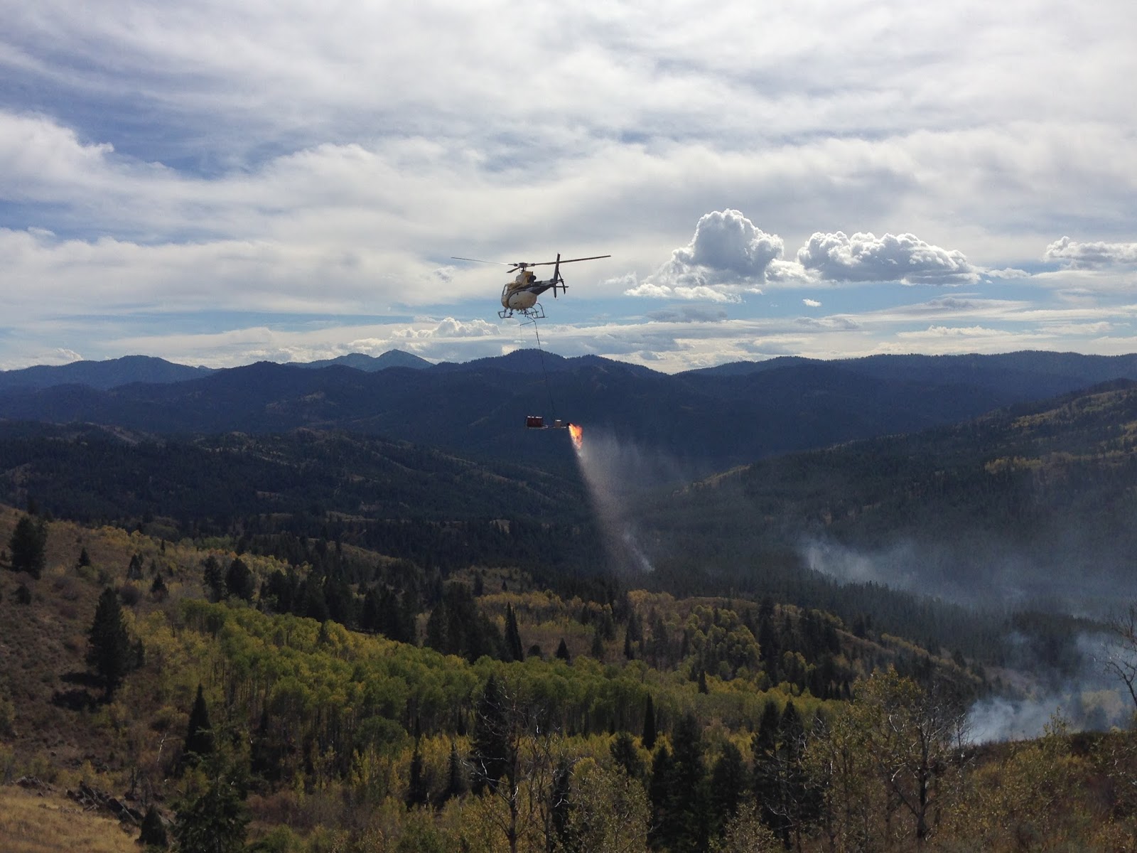
Yesterday the Caribou-Targhee National Forest (CTNF) began work on the Red Creek Prescribed Fire Unit.  The primary focus was on creating an initial perimeter of fireline; firefighters burned about 75 acres using driptorches (as seen in the photo to the left).  Today's work will consist of using a helicopter carrying a helitorch -- simply put, a very large driptorch attached to the aircraft -- to apply fire to the interior areas.

Improved aspen stands are one of the goals of the Red Creek project.  Aspen stands regenerate via roots suckers and thrive on disturbance to spur new growth.  They also require plenty of sunlight, which is often inhibited by overgrowth in absence of fire.  The CTNF is using prescribed fire to mimic the natural process of a fire-adapted ecosystem.


For more information on these and additional prescribed fires on the Caribou-Targhee National Forest, see the tab "Current Wildland Fire Info;" the lower map includes icons identifying the location of these and other projects.